Camperdown to Timboon Rail Trail
IMPORTANT UPDATE: a section of the trail between Merrett’s Road and Bridge 15, about 1 km north of the Trestle Bridge (Glenfyne – Merretts Road – Curdies River Bridge), will be closed from August 2024 until further notice.
Stay up to date here.
Riders and walkers traverse volcanic features, farmland, wooded grassland and tall wet forest on descent into the wooded Timboon valley.
The Timboon Railway Shed Distillery and Timboon Ice Creamery can be found at the end of the trail.
A detour around the current closure can be found here and follows backroads between Glenfyne and Timboon where you can join the Timboon to Port Campbell Trail south.
Full Walk Overview
Type of walk
Self Guided
Trip Length
34 km
Walk Grade
Moderate
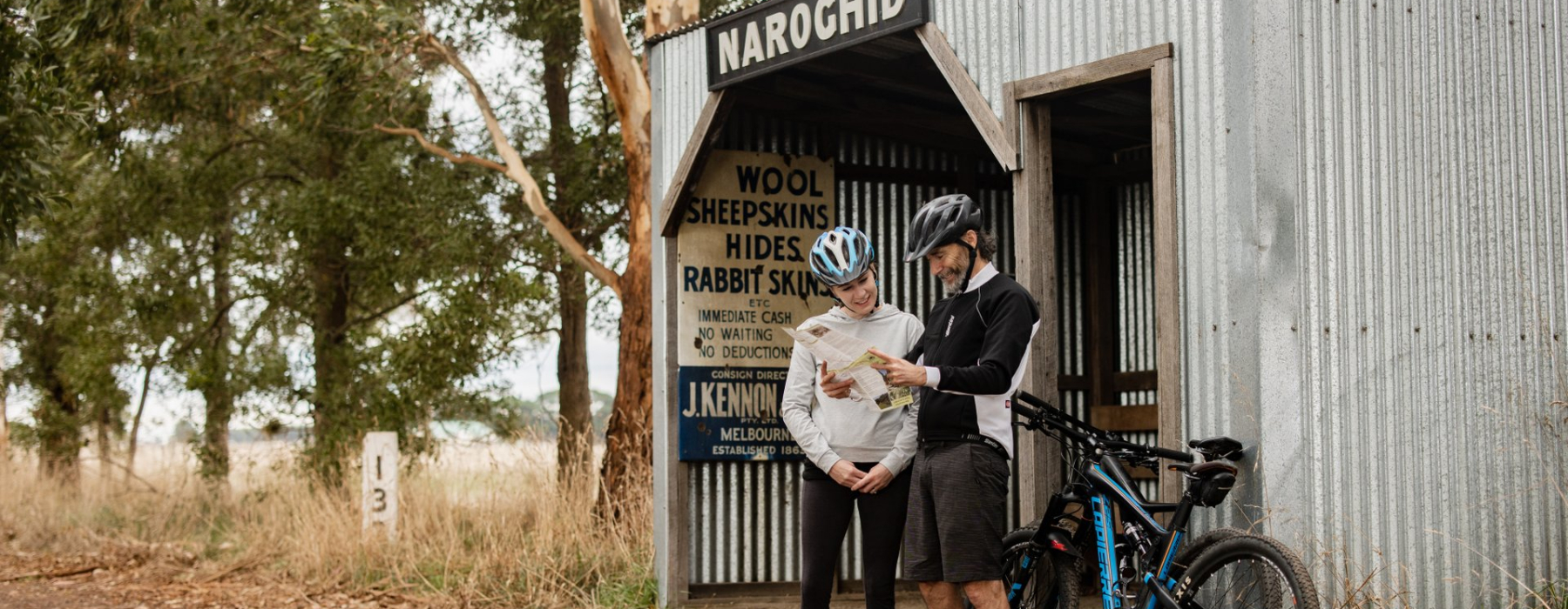
Camperdown to Naroghid
Directions
11km | Steep hill when leaving town travelling south | Sealed roads.
From Camperdown Railway Station travel south along Pike Street, across the Princes Highway to McNichol Street. Turn left at Brooke Street and right into Cobden Road/Leura Street, then immediately right into Fenton Street.
Continue west (and up) along Park Lane, downhill past the Lakes Recreation Reserve and right onto Saddlers Road.
Travel 1.9 km to the T-intersection with Cross Forest Road. Turn left for 3.2 km along Cross Forest Road and again onto Naroghid Road. Ride for 500m along Naroghid Road and turn right to join the Rail trail.
If travelling by car, Naroghid Road is the best place to start walking or riding the Rail Trail.
Naroghid to Cobden
Directions
7 km | Flat, easy walk or ride | Suitable for families
Naroghid Station site has a shelter and picnic facilities. The trail proper passes through farmland as well as native vegetation. There are some farm crossings in this section.
The trail continues through the Cobden Golf Course and has a short steep descent to a bypass bridge.
Horse riders must detour right at Bond Street and turn left at McKenzie Street to rejoin the Rail Trail and bypass the Golf Course.
Follow the signs to the trail adjacent to the Landmark store or detour to the left into Cobden (1 km) for toilets or refreshments.
Cobden to Glenfyne
Directions
11 km | Flat, easy walk or ride | Suitable for families
Travel through farmland and native vegetation. There are 4 major road crossings in this section:
– Cobden – Terang Road (close to Cobden)
– Cobden – Warrnambool Road (3km. from Cobden)
– Cobden – Warrnambool Road at Elingamite Station site (8 km from Cobden)
– Cobden – Warrnambool Road at Glenfyne Station site (11km. from Cobden)
Picnic tables at Glenfyne Hall.
Glenfyne to Merrets Road and Curdies River Bridge
IMPORTANT UPDATE: a section of the trail between Merrett’s Road and Bridge 15, about 1 km north of the Trestle Bridge, will be closed from August 2024 until further notice.
Directions
Glenfyne to Merretts Road: 2 km | Flat, easy walk or ride | Suitable for families
Merretts road to Curdies River Bridge: 5km | Difficult for bike and horse riders, steep descents, narrow trail with sleepers and track still in place
Rail Trail is through native vegetation with farm land abutting the rail reserve.
Picnic facilities are available across Merretts Road.
This is a beautiful, environmentally sensitive area of native vegetation with some threatened species.
This section includes five bypass bridges.
Cyclists and horse riders are advised to dismount at any bridges with steep and slippery approaches.
Picnic facilities at Curdies River Bridge.
Curdies River Bridge to Timboon
Directions
5 km | Flat, easy walk or ride| Suitable for families
Rail Trail passes through native vegetation.
Timboon Station area has picnic facilities, playground and toilets, and is adjacent to Timboon township.
Timboon to Port Campbell
Trail length is 19.5km – trail surface is a mixture of gravel, reinforced plastic boardwalks and sealed concrete pathway, trail is off road with 4 road crossings.
While the trail is complete from Lambert Street Timboon to the cnr of Great Ocean Road and Desaily Street Port Campbell it is not finished.
Trail users will need to dismount in Port Campbell to cross the Great Ocean Road and continue by road or walking on footpath 300m into the township.
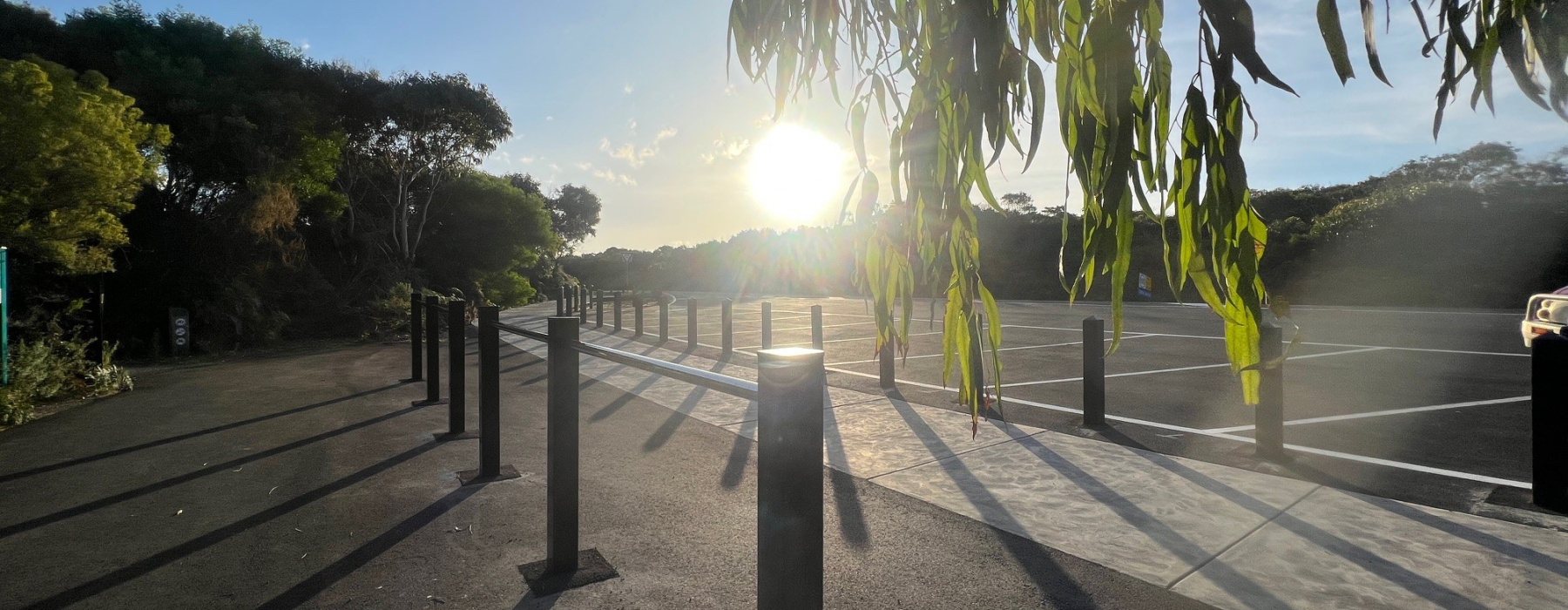
Parking is available at each end of the trail with limited parking along the trail length (see below).
Learn More
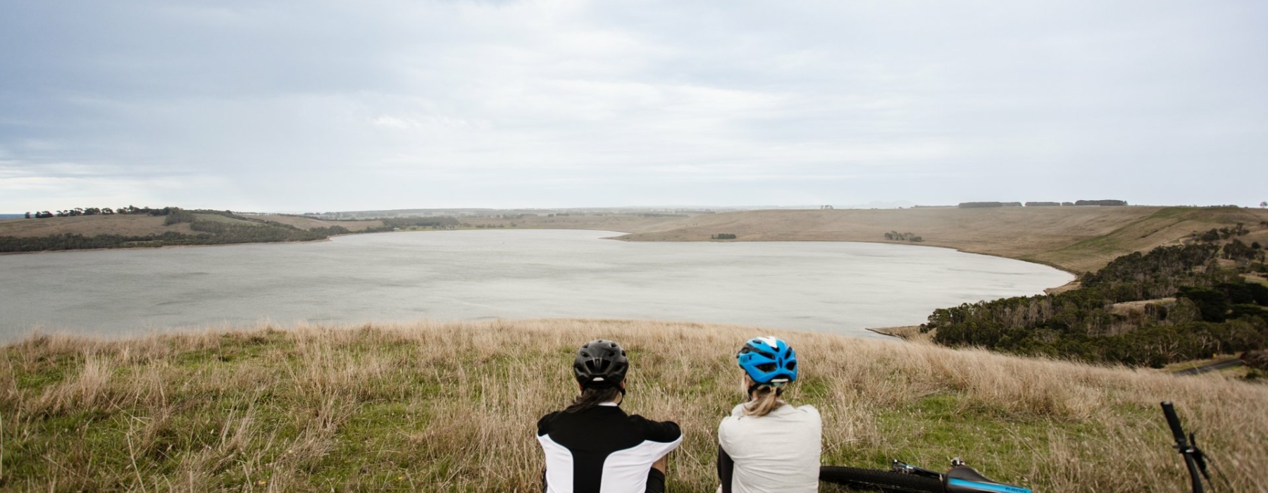
Trail users need to be aware the first section of the trail from Camperdown Station to Naroghid is “on road” and includes a challenging (but spectacular) descent and climb between Lake Bullen Merri and Lake Gnotuk. Visitors are advised to wear bright coloured clothing and switch on a rear tail light to make themselves more visible to other road users.
The trail provides an important connective corridor for native animals. The relationship between native wildlife and the trail is creatively interpreted by a display housed in the Timboon Railway Shed Distillery. This building along with the old ticket office forms the southern terminus of stage 1 of the trail.
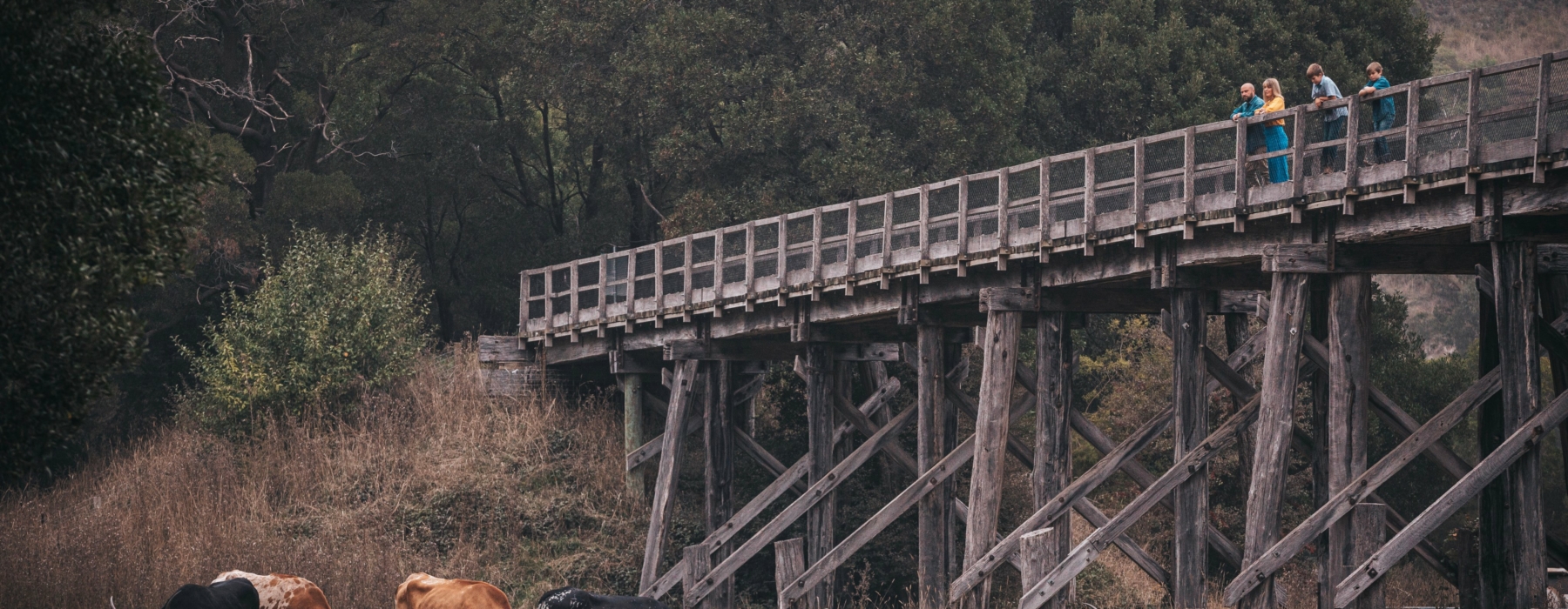
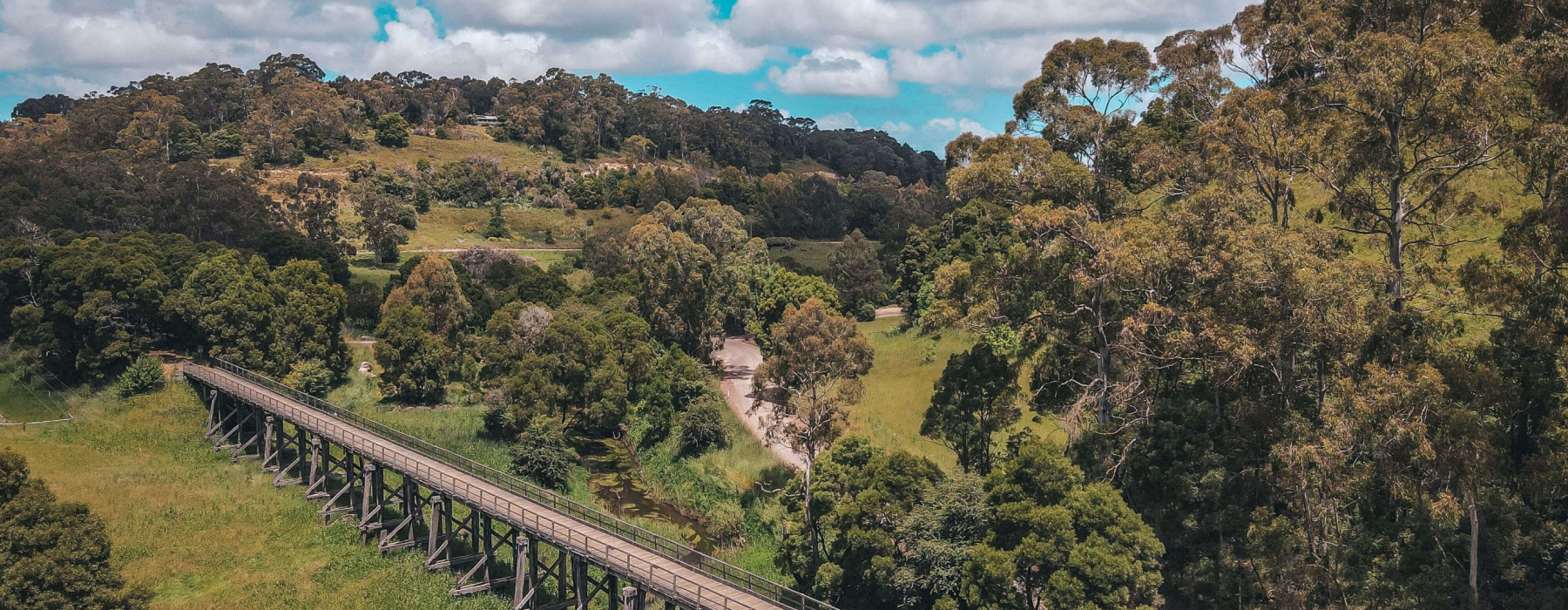
The heritage listed 1891 Timboon Trestle Bridge is accessible via road and via the Coast to Crater trail. The bridge provided a vital link via standard gauge to Camperdown and Melbourne. Nowadays visitors can enjoy a picnic in a picturesque valley formed by the Curdies River.
There are many remnant trestle bridges along the Camperdown Timboon Rail Trail many covered in moss and surrounded by ferns offering great photo opportunities along the way.
Sections of the trail between Glenfyne and the Curdies Trestle Bridge are more challenging and are best suited to hybrid and mountain bikes with wider tyres and front suspension. Sections of trail between the old rail sleepers are bumpy and there are sections that require a dismount and walking to negotiate ruined trestle bridge bypasses. Take your time and take it easy on these sections as these are among the most picturesque sections of the trail.
Timboon to Port Campbell Trail now links the Camperdown to Timboon Rail Trail with the coast.
